
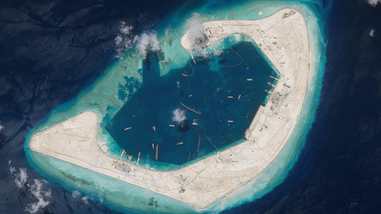
New satellite images suggest China’s land reclamation at Antelope Reef in the South China Sea is nearly finished, according to researchers.
One image taken on June 22 showed that dredgers within the lagoon of the teardrop-shaped coral atoll in the Paracel Islands had been replaced by cargo barges, an indication that land reclamation was near completion, London-based research group the Open Source Centre (OSC) said on social media on Friday.
Meanwhile, four large, blue cylindrical storage silos have appeared at what looks like a concrete production plant in the northwest part of the reef, according to one image taken on June 24 – a sign that construction may be moving into the heavy infrastructure phase.
Notably, one of the images released by the OSC showed that a long, reinforced quay was firmly in place in the southwestern corner of the lagoon.
“This enhances its waterfront infrastructure as the reclaimed feature steadily develops into China’s largest artificial island in the South China Sea,” Damien Symon, a researcher with global intelligence research network The Intel Lab, said on social media, referring to the quay.
After a hiatus of nearly a decade, China jump-started its island-building campaign around October last year, when new dredging began at Antelope Reef, American news magazine Newsweek reported in early January, citing satellite imagery.
A March analysis of satellite images by the Asia Maritime Transparency Initiative under the Centre for Strategic and International Studies (CSIS) estimated that roughly 603 hectares (1,490 acres) of land had been reclaimed at the reef, known as Lingyang Jiao in China and Da Hai Sam in Vietnam.