
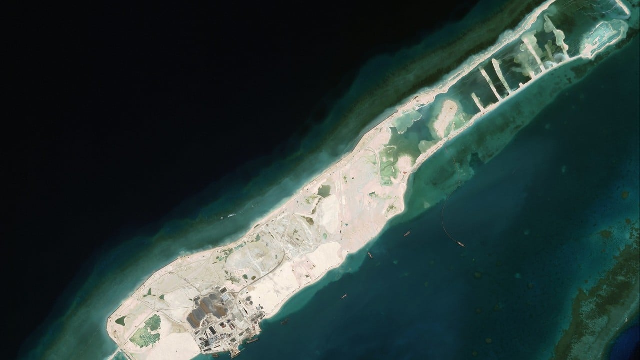
Vietnam has dramatically expanded its presence on Barque Canada Reef through a three-year land-reclamation project enabling large warships to sail into the harbour, according to a study by China’s Ministry of Natural Resources.
Advertisement
The research combines laser measurements from Nasa’s ICESat-2 satellite with optical data from the European Union’s Sentinel-2 to map underwater changes with unprecedented precision. The team’s peer-reviewed paper was published in the Chinese-language Journal of Tropical Oceanography on February 13.
Barque Canada Reef is the largest landform in the Spratly Islands, an archipelago in the South China Sea that is claimed by several nations and is known in China as the Nansha Islands.
According to the paper, the research revealed that Vietnam had dredged a 299-metre (980-foot) wide channel reaching an average depth of 11.37 metres leading into the strategic harbour at the western tip of Barque Canada Reef, which is known in China as Bai Jiao.
The channel is deep enough to accommodate some of the world’s largest warships, such as China’s largest Type 055 destroyers that have a 6.6-metre draught, according to openly available information.
Advertisement
From 2022 to 2024, reclaimed land at the reef expanded tenfold to 1.94 sq km (0.75 square miles), placing concrete over coral flats, according to the study.
“These data [are] conclusive proof that Vietnam’s land-reclamation projects, coupled with the excavation of navigation channels and harbour construction, have profoundly reshaped Bai Jiao Reef’s topography, triggering drastic geomorphological alterations across the island complex,” wrote study co-author Fu Dongyang, of Guangdong Ocean University.