
Hong Kong has enjoyed a storm-free August but residents must remain vigilant for a handful of typhoons expected in the months ahead, according to the city’s weather forecaster and a local expert.
A day after the Observatory predicted Hong Kong could experience “three to five” more typhoons this year, one of its scientific officers further explained to the Post that the low number in the first part of the year did not necessarily mean there would be fewer during the rest of the season.
“While the number of tropical cyclones from January to July is usually significantly reduced in years when El Nino weakens, it doesn’t mean that the number throughout the year is necessarily below normal,” Jennifer Yip Ling said on Friday.
“We also have to take into account that there is a possibility of La Nina developing towards the end of the year.”
El Nino and La Nina refer respectively to the warming and cooling of surface water in the central and eastern equatorial Pacific Ocean which affect atmospheric circulation worldwide.
During La Nina events, tropical cyclones from August to October are likely to be driven by an anomalous steering flow into the South China Sea and hence more tropical cyclones are likely to affect Hong Kong.
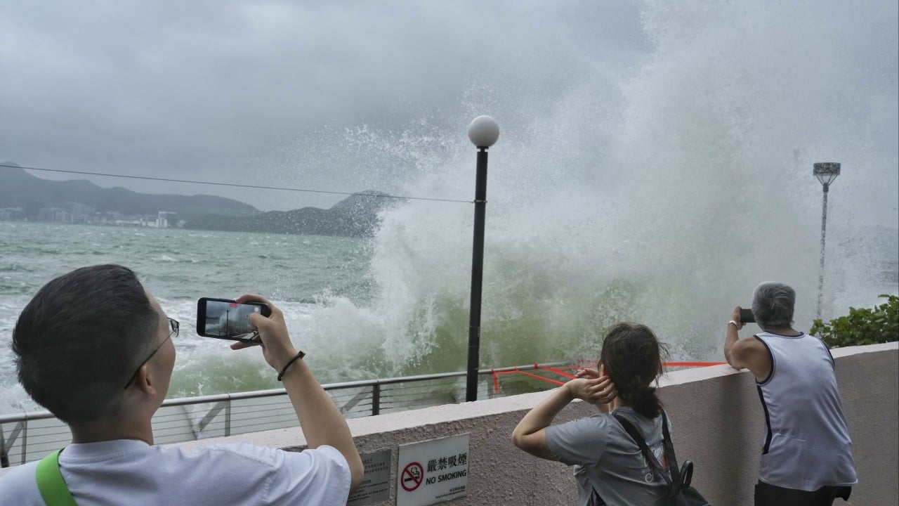
On Thursday, the Observatory wrote in a blog post that Hong Kong’s storm season had entered an “intermission” after being affected by Tropical Storm Maliksi from late May to early June and Severe Tropical Storm Prapiroon in mid-July.
It said conditions this month had been unfavourable for tropical storms to form, leading to the first storm-free August in the South China Sea since 2014. There were also no storms in August in 1985, 1988 and 1989.
But the forecaster cautioned that storms could still approach Hong Kong well into October or even November, and predicted that three to five storms might still move within 500km of the city in the rest of the year.
“We still have to wait and see how the ‘second half’ of the storm season plays out. Regardless, we still need to be prepared for the rest of the typhoon season,” the forecaster said.
Leung Wing-mo, a former Observatory assistant director, said the forecast served as a timely reminder that the storm season was not over yet.
He said the city had seen some of the most powerful storms – including Super Typhoons Hato in 2017 and Mangkhut in 2018 – in September. But Leung expressed scepticism about the significance of the La Nina factor.
“The accuracy of forecasting the number of tropical cyclones in such longer terms is actually very low,” he said.
“The discussion is very interesting but not very precise, because our ability to predict the weather one or two months from now is very limited.”
He added as westerly flows picked up later into the autumn, tropical storms would be driven to move northeastward, away from southern China and towards Japan.
Meanwhile, the Observatory said on Friday that an area of low pressure to the east of the Philippines was expected to develop gradually in the next few days while moving towards the vicinity of Luzon island.
“However, there are still uncertainties in its subsequent movement and intensity,” the forecaster said.
The automated European computer model ECMWF shown on the Observatory’s website suggests that the storm may move towards Taiwan later next week. Two other Chinese computer models predict the storm will veer into the South China Sea after making landfall on Luzon.
